Renaissance: Your Other Option Alongside UAS
Some people claim that you can’t mimic imagery from an unmanned aerial system (UAS). Although we’re experienced with the immense power of UAS, we’ll have to disagree to a certain extent.
We’d like you to meet Renaissance. Renaissance is a low-and-slow-flying camera system on a small, manned aircraft. Designed to copy the flight characteristics and image products from UAS, it has proven to be useful during times of heavy UAS restrictions.
Unlike traditional orthophotography, Renaissance uses a full-frame DSLR camera to produce ultrahigh-resolution imagery and elevation data. Coupled with the latest in computer vision software, Renaissance produces high-density 3D colorized point clouds for purposes including corridor and infrastructure planning.
Applying Renaissance to the Energy Market
Typically, the energy industry has used lidar and traditional aerial imagery for corridor planning, maintenance and mapping. For engineering planning purposes, Renaissance has the advantage of speed—Woolpert is able to produce point clouds derived from imagery within a few days after collection. Absolute accuracies that support engineering planning are achievable when combined with traditional survey. In the end, the customers receive two distinct products from a single acquisition and data processing workflow: an ultrahigh-resolution orthomosaic and a 3D colorized point cloud.
Recently, we put Renaissance to the test. It passed with flying colors.
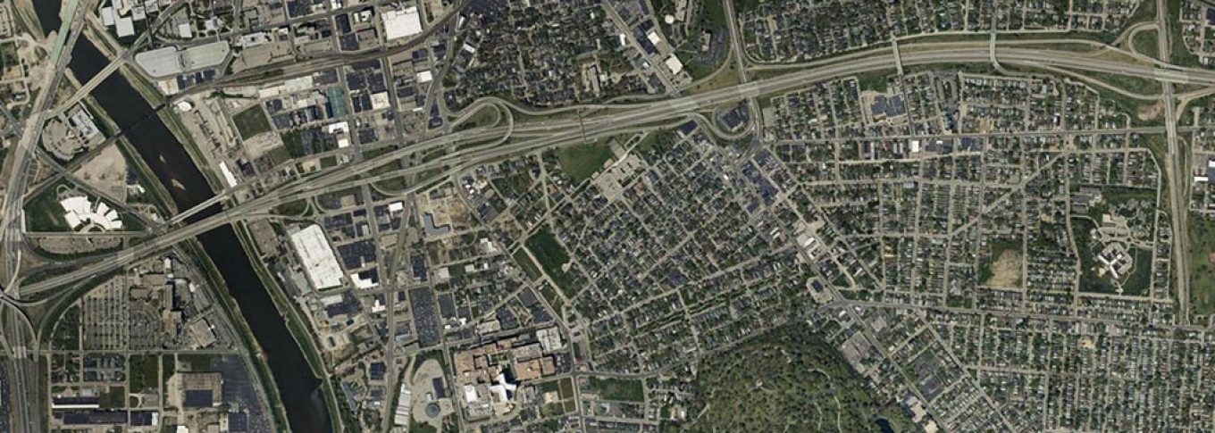
Using Renaissance, the client was able to quickly assess a 50-mile proposed corridor in an extremely urban environment. The approach removed the need for excessive field work and time-intensive survey access. In addition, the data was captured in a fraction of the time it takes for traditional aerial and survey methods. It allowed engineers and planners to quickly begin preliminary routing—taking into account current corridor activities, ultimately reducing reroute expenses. The client could also map the corridor in both 2D and 3D with the data that was generated.
This combination of timeliness, high resolution and cost efficiency will drastically reduce costs and for this corridor project. As construction continues, the story will only get better. Check back in later to find out more.
UAS technology promises new opportunities for the geospatial community; however with heavy national restrictions still in place, we’re happy to provide an alternative solution, Renaissance, to your imagery and data-processing needs.