Top 7 Geospatial Trends to Watch in 2018
Let’s talk geospatial trends. Here are the seven that I predict will dominate the geospatial community’s 2018 conversation:
Read More
The Eyeball Perspective
Cartography offers an opportunity to view our world from a variety of unique perspectives. For thousands of years, cartographers have tried to create flat representations of our round planet by partitioning, measuring, mosaicking and controlling its surface. Modern cartography has further unlocked entire industries of analysis and intelligent decision-making about the land and our impact […]
Read More
Small UAS: Don’t Be Disrupted By Disruptive Technology
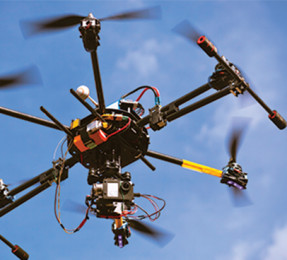
Drones, unmanned aircraft systems (UAS), unmanned aerial vehicles (UAV)—whatever you prefer to call them—are taking the geospatial community by surprise. UAS are almost becoming disruptive technology, or new technology introduced to society that deviates from the norm and changes the way we do business.
Read More
Live from Autodesk University 2017
Day 1: Advanced Computational Design with Dynamo Nodes and lists and code blocks OH MY! Day 1 at Autodesk University (AU) in Las Vegas kicked off with several computational BIM workshops. I headed to the advanced BIM session featuring Dynamo, an amazing tool that enables users to create custom routines, manipulate geometry and extract data […]
Read More