Work Smarter, Not Harder
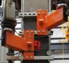
Everyone has heard the age-old saying, “Work smarter, not harder.” Nowhere is this concept more applicable than as a result of the Internet of Things’ aptitude for automating and communicating manual tasks. Tracking the daily measurements of seemingly unchanging interior spaces can be terribly tedious. Yet when large, heavy equipment begins shifting positions, the demand […]
Read More
Saying Goodbye: The Vanishing Reality of NAD83 and NAVD88
I recently attended the National Geodetic Survey’s (NGS) workshop on the future of the horizontal and vertical datums. Industry leaders and software companies gathered with NGS representatives to discuss the logistics and implications of migrating to new datums. Since the 1980s, the United States and some North American neighbors have used the North American Datum […]
Read More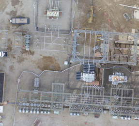
Micro-Scale Photogrammetry: UAS for Construction Monitoring
Point 1: Photogrammetry is not a new science. For hundreds of years, photogrammetry has been applied successfully across varied and vast geospatial extents to help users understand and analyze their environments. Point 2: Unmanned aircraft systems (UAS) allow for the quick and efficient acquisition of aerial imagery—the very building blocks of photogrammetry. A single UAS […]
Read More
CARTO Locations 2018 – A New Era of GIS
At their Locations conference in Brooklyn this year, CARTO set forth a new vision for their company and the GIS industry, as a whole. CARTO is moving away from “traditional GIS” and focusing their platform on what they call “location intelligence”. Traditionally, GIS has focused on visualization and calculation, but CARTO aims to be in […]
Read More